Bestand:Political map of the Low Countries (1350)-NL.svg
Naar navigatie springen
Naar zoeken springen


Afmetingen van deze voorvertoning van het type PNG van dit SVG-bestand: 468 × 599 pixels Andere resoluties: 187 × 240 pixels | 375 × 480 pixels | 469 × 600 pixels | 600 × 768 pixels | 800 × 1.024 pixels | 2.818 × 3.608 pixels.
Afbeelding in hogere resolutie (SVG-bestand, nominaal 2.818 × 3.608 pixels, bestandsgrootte: 886 kB)
Beschrijving
| Beschrijving |
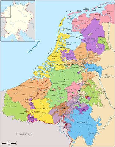
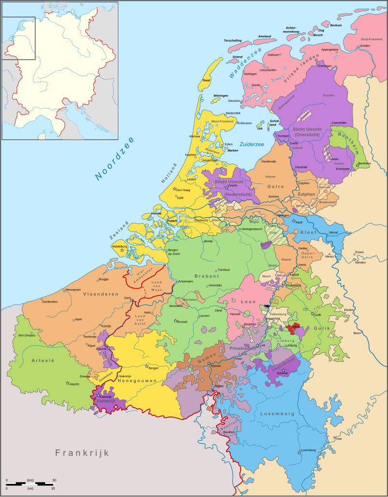
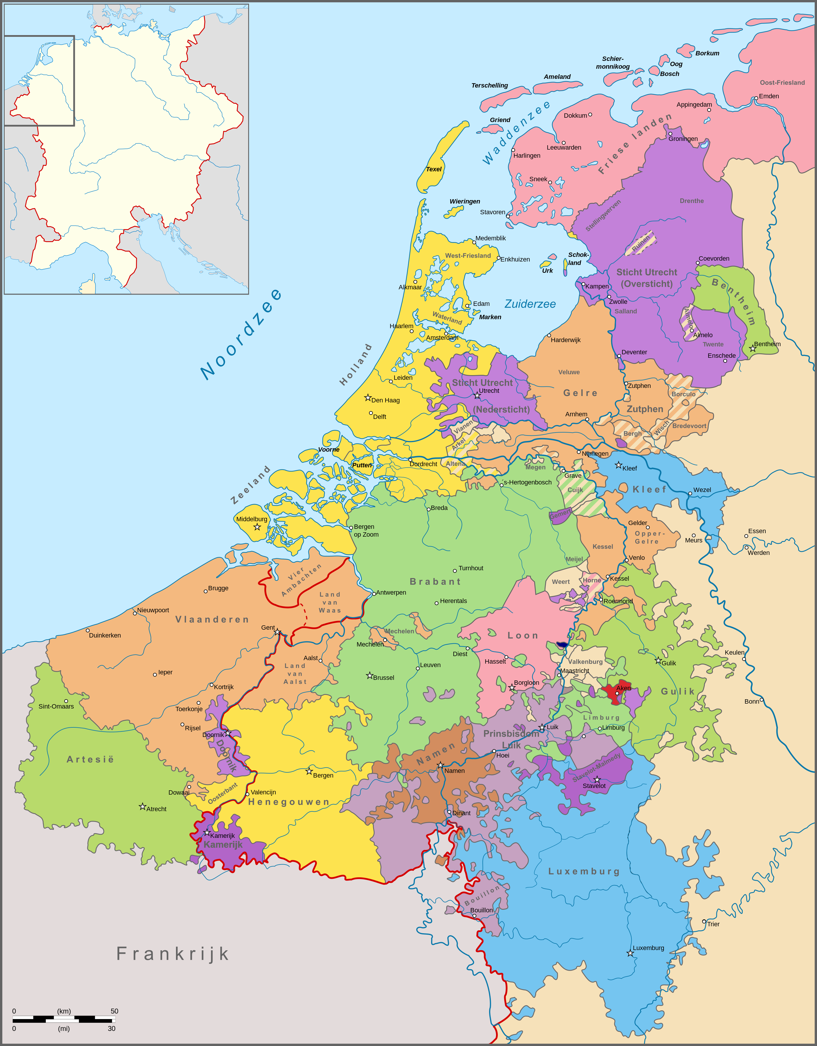
English: Map of the political situation in the Netherlands around 1350. Nederlands: Kaart van de politieke situatie in de Nederlanden omstreeks 1350. |
| Datum | |
| Bron | Eigen werk |
| Auteur | Sir Iain |
| Andere versies |
cropped File:Political map of Limburg (1350)-NL.svg
|
-hu.svg)
-NL.svg)
-NL.svg)
Licentie
Ik, de auteursrechthebbende van dit werk, maak het hierbij onder de volgende licentie beschikbaar:
Dit bestand is gelicenseerd onder de Creative Commons-licentie Naamsvermelding-Gelijk delen 3.0 Unported
- De gebruiker mag:
- Delen – het werk kopiëren, verspreiden en doorgeven
- Remixen – afgeleide werken maken
- Onder de volgende voorwaarden:
- naamsvermelding – U moet op een gepaste manier aan naamsvermelding doen, een link naar de licentie geven, en aangeven of er wijzigingen in het werk zijn aangebracht. U mag dit op elke redelijke manier doen, maar niet zodanig dat de indruk wordt gewekt dat de licentiegever instemt met uw werk of uw gebruik van zijn werk.
- Gelijk delen – Als u het materiaal remixt, transformeert of erop voortbouwt, moet u uw bijdragen verspreiden onder dezelfde licentie als die van het origineel, of een licentie die daarmee verenigbaar is.
Bestandsgeschiedenis
Klik op een datum/tijd om het bestand te zien zoals het destijds was.
| Datum/tijd | Miniatuur | Afmetingen | Gebruiker | Opmerking | |
|---|---|---|---|---|---|
| huidige versie | 15 nov 2011 15:36 | | 2.818 × 3.608 (886 kB) | Sir Iain |
Bestandsgebruik
Dit bestand wordt op de volgende pagina gebruikt:
-NL.svg)