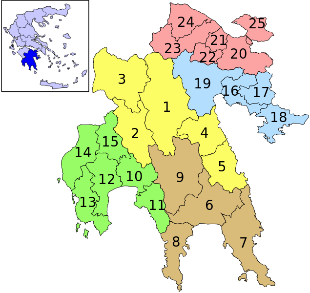
Bestand:Perifereia Poloponnisou Numbered.svg
Naar navigatie springen
Naar zoeken springen


Afmetingen van deze voorvertoning van het type PNG van dit SVG-bestand: 635 × 600 pixels Andere resoluties: 254 × 240 pixels | 508 × 480 pixels | 813 × 768 pixels | 1.084 × 1.024 pixels | 739 × 698 pixels.
Afbeelding in hogere resolutie (SVG-bestand, nominaal 739 × 698 pixels, bestandsgrootte: 153 kB)
Bestandsgeschiedenis
Klik op een datum/tijd om het bestand te zien zoals het destijds was.
| Datum/tijd | Miniatuur | Afmetingen | Gebruiker | Opmerking | |
|---|---|---|---|---|---|
| huidige versie | 12 nov 2010 10:23 |  | 739 × 698 (153 kB) | Panagiotis Botsis | {{Information |Description={{en|1=The new administrative division of Peloponnese Periphery, Greece}} |Source={{own}} |Author=Panagiotis Botsis |Date= |Permission= |other_versions= }} [[Category:Locator maps of municipalities of |
Bestandsgebruik
Dit bestand wordt op de volgende pagina gebruikt:
