Bestand:Map - NL - Municipality code 0289 (2009).svg
Naar navigatie springen
Naar zoeken springen


Afmetingen van deze voorvertoning van het type PNG van dit SVG-bestand: 300 × 160 pixels Andere resoluties: 320 × 171 pixels | 640 × 341 pixels | 800 × 427 pixels | 1.024 × 546 pixels | 1.280 × 683 pixels.
Afbeelding in hogere resolutie (SVG-bestand, nominaal 300 × 160 pixels, bestandsgrootte: 529 kB)
| Beschrijving |
|
|||
| Datum | ||||
| Bron | own work , using CBS data | |||
| Auteur | Michiel1972 (talk) 22:12, 24 January 2009 (UTC) | |||
| Toestemming (Hergebruik van dit bestand) |
Attribution ShareAlike 3.0 |

.svg)
Dit bestand is gelicenseerd onder de Creative Commons-licentie Naamsvermelding-Gelijk delen 3.0 Unported
- De gebruiker mag:
- Delen – het werk kopiëren, verspreiden en doorgeven
- Remixen – afgeleide werken maken
- Onder de volgende voorwaarden:
- naamsvermelding – U moet op een gepaste manier aan naamsvermelding doen, een link naar de licentie geven, en aangeven of er wijzigingen in het werk zijn aangebracht. U mag dit op elke redelijke manier doen, maar niet zodanig dat de indruk wordt gewekt dat de licentiegever instemt met uw werk of uw gebruik van zijn werk.
- Gelijk delen – Als u het materiaal remixt, transformeert of erop voortbouwt, moet u uw bijdragen verspreiden onder dezelfde licentie als die van het origineel, of een licentie die daarmee verenigbaar is.
Bestandsgeschiedenis
Klik op een datum/tijd om het bestand te zien zoals het destijds was.
| Datum/tijd | Miniatuur | Afmetingen | Gebruiker | Opmerking | |
|---|---|---|---|---|---|
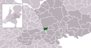
| huidige versie | 24 jan 2009 23:12 | | 300 × 160 (529 kB) | Michiel1972 | {{Information |Description=*Location maps for the 441 municipalities in the Netherlands. Boundaries 1/1/2009 *Automatically generated with script *File name contains "Municipality code" (CBS-code) as specified in: [http://www.cbs.nl/nl-NL/menu/methoden/c |
Bestandsgebruik
Dit bestand wordt op de volgende pagina gebruikt:
.svg)