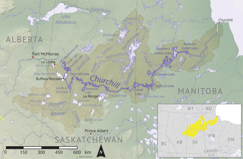
Bestand:Churchill river hudson basin map.png
Naar navigatie springen
Naar zoeken springen


Grootte van deze voorvertoning: 800 × 525 pixels. Andere resoluties: 320 × 210 pixels | 640 × 420 pixels | 1.024 × 672 pixels | 1.200 × 788 pixels.
Afbeelding in hogere resolutie (1.200 × 788 pixels, bestandsgrootte: 1,6 MB, MIME-type: image/png)
Bestandsgeschiedenis
Klik op een datum/tijd om het bestand te zien zoals het destijds was.
| Datum/tijd | Miniatuur | Afmetingen | Gebruiker | Opmerking | |
|---|---|---|---|---|---|
| huidige versie | 7 nov 2019 05:16 |  | 1.200 × 788 (1,6 MB) | Shannon1 | {{Information |description ={{en|1=Map of the Churchill River (Hudson Bay) drainage basin. Data derived from NASA SRTM, Natural Resources Canada, US Geological Survey, Natural Earth, all public domain.}} |date =2019-11-03 |source =Own work |author =Shannon1 }} Category:Churchill River |
Bestandsgebruik
Dit bestand wordt op de volgende pagina gebruikt:
