Bestand:Antarctica map.jpg
Naar navigatie springen
Naar zoeken springen

Grootte van deze voorvertoning: 686 × 599 pixels. Andere resoluties: 275 × 240 pixels | 550 × 480 pixels | 687 × 600 pixels | 879 × 768 pixels | 1.173 × 1.024 pixels | 4.549 × 3.973 pixels.
Afbeelding in hogere resolutie (4.549 × 3.973 pixels, bestandsgrootte: 6,18 MB, MIME-type: image/jpeg)
| Uitgever |
Justus Perthes |
||||
| Beschrijving |
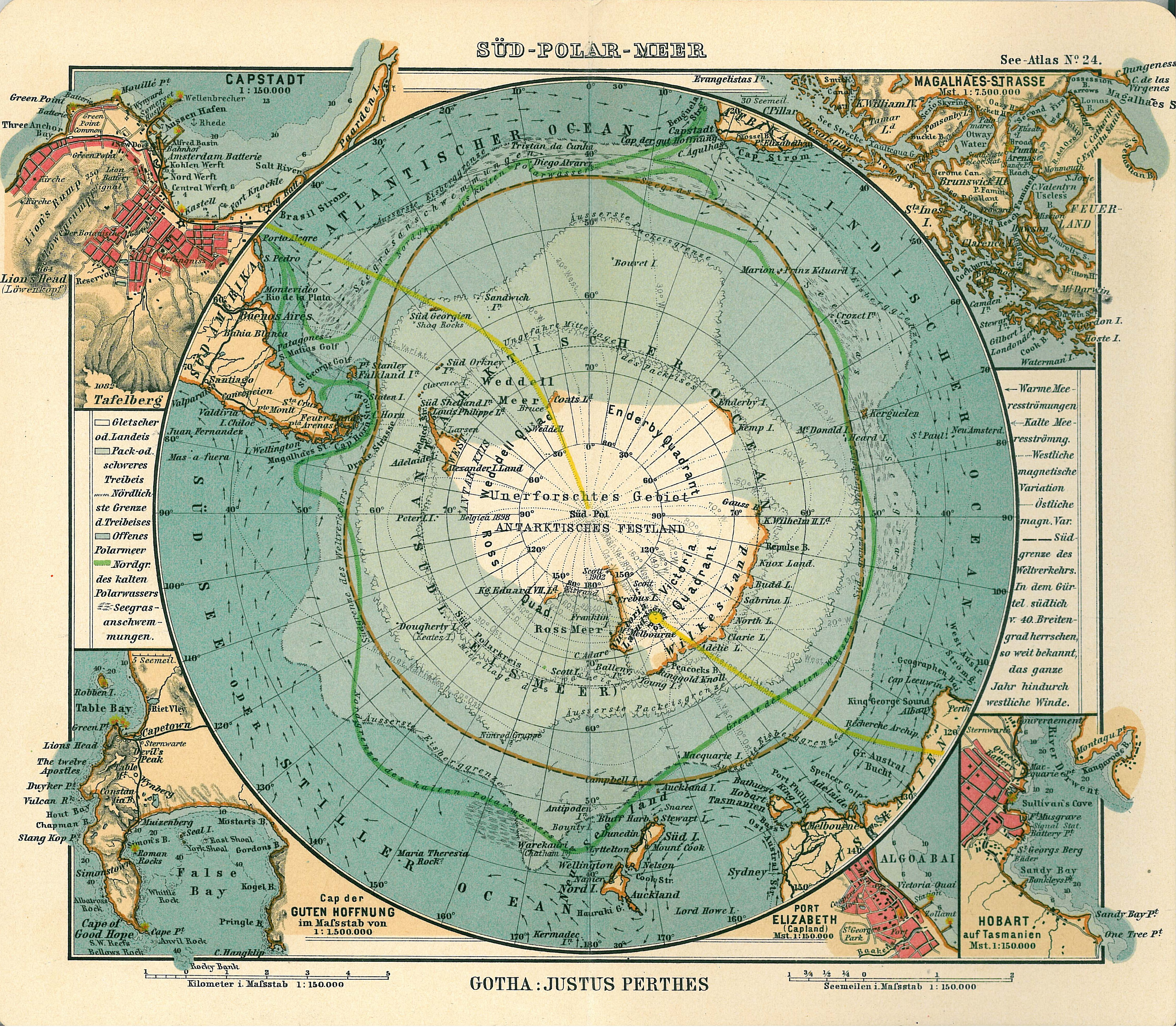
Deutsch: Blatt 24, Süd-Polar-Meer
English: Page 24, Antarctica, Inset maps of Cape town, Cape of good hope, Magalhaes strait, Hobart, Port Elizabeth |
||||
| Datum van uitgave | 1906 | ||||
| Plaats van uitgave | Gotha | ||||
| Bron | See Atlas | ||||
| Toestemming (Hergebruik van dit bestand) |
|
||||
.jpg)
Bestandsgeschiedenis
Klik op een datum/tijd om het bestand te zien zoals het destijds was.
| Datum/tijd | Miniatuur | Afmetingen | Gebruiker | Opmerking | |
|---|---|---|---|---|---|
| huidige versie | 15 jan 2007 18:08 | | 4.549 × 3.973 (6,18 MB) | Martas011 | Category:Old maps of Antarctica Category:Maps of oceans Category:Maps of the Southern Ocean Good map of Antarctica, Justhus Perthes See Atlas 1906 Inset maps of Cape town, Cape of good hope, Magalhaes strait, Hobart, Port Elizabeth |
Bestandsgebruik
Geen enkele pagina gebruikt dit bestand.