Bestand:2016-Brussels-Bombings-OpenStreetMap.png
Naar navigatie springen
Naar zoeken springen


Grootte van deze voorvertoning: 800 × 521 pixels. Andere resoluties: 320 × 208 pixels | 640 × 417 pixels | 1.024 × 667 pixels | 1.280 × 834 pixels | 4.924 × 3.208 pixels.
Afbeelding in hogere resolutie (4.924 × 3.208 pixels, bestandsgrootte: 19,66 MB, MIME-type: image/png)
| Beschrijving |
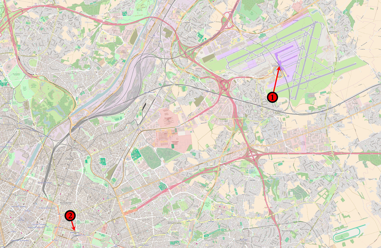
English: Map of the March 2016 Brussels bombings in relation to each other. (1) 08:00 : Concourse B of Brussels Airport. (2) 09:15 : Brussels Maelbeek metro station |
|||
| Datum | ||||
| Bron | Base map from OpenStreetMap | |||
| Auteur | Veggies | |||
| Toestemming (Hergebruik van dit bestand) |
Dit bestand is gelicenseerd onder de Creative Commons-licentie Naamsvermelding-Gelijk delen 2.0 Unported
|
Bestandsgeschiedenis
Klik op een datum/tijd om het bestand te zien zoals het destijds was.
| Datum/tijd | Miniatuur | Afmetingen | Gebruiker | Opmerking | |
|---|---|---|---|---|---|
| huidige versie | 23 mrt 2016 01:05 | | 4.924 × 3.208 (19,66 MB) | Veggies | {{Information |Description ={{en|1=Map of the March 2016 Brussels bombings in relation to each other.<br /> '''(1)''' 08:00 : Concourse B of Brussels Airport.<br />'''(2)''' 09:15 : ''Brussels Maelbeek metro station''}} |Source =Base map fro... |
Bestandsgebruik
Geen enkele pagina gebruikt dit bestand.